
| View Slideshow | |||
|
|
|
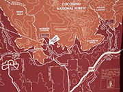
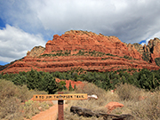
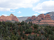
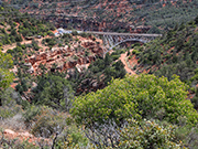
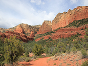
Jim Thompson Trail - Directions: From the junction of Routes 89A and 179, take 89A north 0.3 miles to Jordan Road on the left. Follow Jordan Road into the Jordan Park subdivision and turn left onto Park Ridge Drive at the "T". Continue 0.4 miles to parking near the gate at the end of a short stretch of unpaved road. This is a 6 mile round trip trail if you go all the way to the second trailhead at Migley Bridge. Since it is not a loop trail, you can turn around at any time. This trail has great views and is relatively easy with about 500 feet elevation gain. For more details on this hike, go to Coconino National Forest |

|

|

|
|
|
|
|
|

|

|

|
|

|
|

|
|

|
|

|

|
|
|
|

|

|

|
|