
| View Slideshow | |||
|
|
|
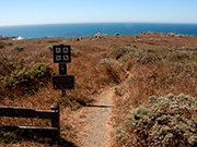
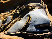
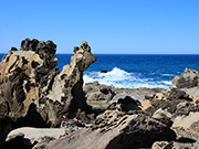
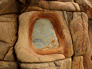
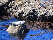
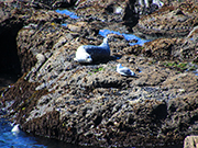
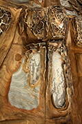
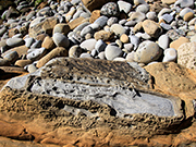
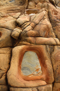
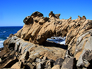
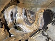
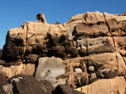
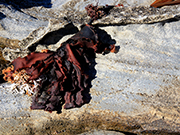
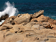
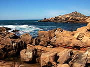
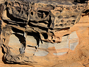
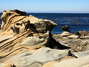
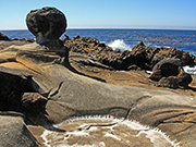
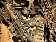
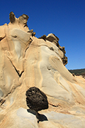
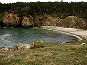
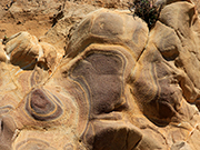
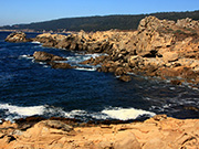
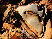
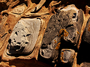
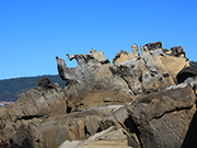
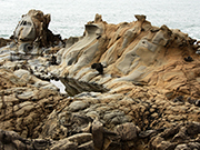
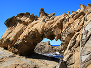
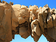
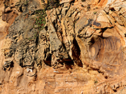
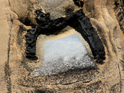
Salt Point State Park is located about 19 miles north of Jenner, California on coast Hwy. 1. The 6,000 acre park offers picnicking, hiking, camping and diving (it has one of California's first underwater parks). It has beautiful cove beaches and rocky shorelines. While there are 6 miles of rugged coastline, what is unique and of most interest to me as a photographer is that there is a section with very interesting sandstone formations along the shoreline, which is rare along the California coastline. This sandstone is deeply eroded and pitted. This is called tafoni which refers to a honeycomb-type erosion caused by seasonal wetting and drying of the sandstone. It is quite amazing with very smooth and very pitted areas, and it ranges in color from almost white to black with other colors, especially blue, in places. There is also a very beautiful arch. My photographs mostly show this area which I find fascinating. To reach the trail, there is parking alongside the highway .5 miles south of the Stump Beach entrance or .8 miles north of the Gersle Campground sign. A short trail across from the parking (shown in the first slide) leads to the beach and these sandstone formations. The trail forks a couple times. If you keep to the right, it will take you to the area where you can see the arch. You have to go down close to the water’s edge to see it, but it is quite spectacular and very unusual along the California coast. This is not really a hike - more like a stroll along the coastline. However, to see the rock formations, you must leave the trail and walk down on the sandstone. You can continue going either north or south to see other sights. In the spring, May and June, there is an abundance of wild flowers. |
|
|
| |
|
|
|
|
|
|
|
|

|
|
| |
|
|
|
|
|
|
|
|
|
|
|
|
|
|
|
|
|
|

|
|
|
|
|
|